

Android Team Awareness Kit (ATAK) was originally created by the US DoD for military applications over a decade ago. Now a Civilian version is available for use by first responders and other agencies for free. Download it now from the play store or learn more about its history at TAK.gov.


Bridge Adapters
Organizations can now create and manage their own bridge adapters. Bridge adapters allow 3rd party systems to send and receive data to Sit(x) groups and allows Sit(x) integrators to develop microservices to inject an interoperability layer for TAK consumers. Bridge adapters have the same security requirements as regular connections but have a different authentication strategy that is more amenable to enterprise environments.
Data Sync
The Sit(x) product now includes DataSync. In our initial rollout users of WinTAK can leverage DataSync to create, view, and update missions via the DataSync tool. We are currently beta testing ATAK support for this new feature and expect to have that rolled out to users in the coming weeks.

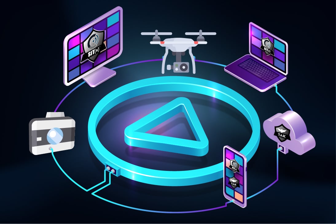
GvStreamer
Our GvStreamer product allows users to livestream UAS video, device video, and stationary camera video securely without overcomplicating things. Users can configure access to video sources from within the Sit(x) web user interface. To access this feature login to your Sit(x) dashboard and use the Administration -> Video Aliases menu to access your existing video aliases. Clicking or tapping on the Add Alias button in the upper right corner will let you specify a new video alias that can be shared with your TAK users by using the built in video tool.
Security & Privacy Controls
With Sit(x), your data is your data. We have taken additional steps to ensure your data remains private through newly implemented policies and security controls. We will have many more updates to follow on this front in the coming months so please stay tuned!
/Security_Privacy_Controls.jpg?width=1094&height=730&name=Security_Privacy_Controls.jpg)
Sit(x)™ for Android - Using TAK effectively requires a TAK Server backend connection. Sit(x) is a Next Generation TAK Server-as-a-Service solution. Hosted in the FedRAMP compliant AWS GovCloud and built by the same company that has been developing TAK for over a decade, Sit(x) an easy and intuitive user experience, allowing organizations to sign up and deploy in minutes.
Sit(x)™ for iOS is your mobile situational awareness solution for any situation. For the first time, iOS users have the ability to operate in real time on a moving map display, allowing you to visualize real time data. What started as a military software requirement for United States Special Operations Forces over a decade ago is now a commercially available piece of technology available to everyone globally.
WinTAK-CIV for Windows has a feature set similar to ATAK-CIV. Developed to run on Windows PCs and Windows Surface devices, the WinTAK user experience is consistent with Microsoft applications. it maintains the look and feel of ATAK and works seamlessly with the Sit(x) TAK Server. Download the latest approved version of WinTAK, at TAK.gov (requires account registration).